Services
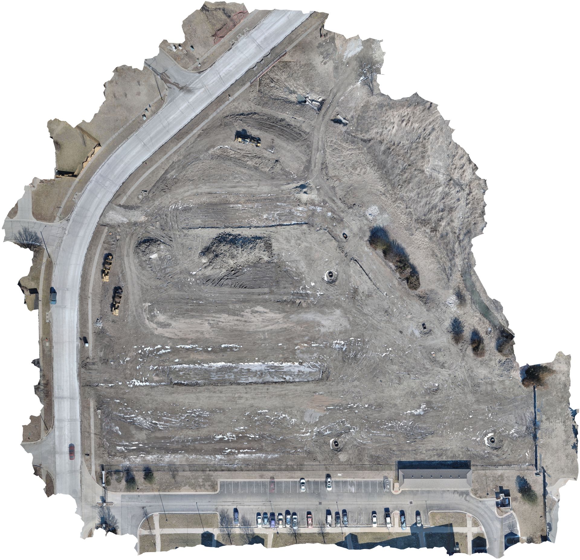
2D & 3D Photogrammetry Ortho-mosaics
Enhance project site documentation with high-resolution aerial imagery and geospatially accurate 2D and 3D orthomosaics. Our photogrammetry solutions provide a detailed visual record of site progression, aiding construction teams, engineers, and surveyors. By integrating aerial data, we help surveyors improve accuracy while reducing the time required for field measurements—allowing them to focus on high-precision tasks with greater efficiency.
Digital Twins

Create detailed, data-rich digital replicas of physical assets and environments. Our Digital Twin technology enables real-time monitoring, predictive maintenance, and enhanced decision-making for industries such as energy, telecommunications, and urban planning.
Aerial Inspections
Reduce downtime and improve safety with our advanced aerial inspections. Whether assessing wind turbines, solar farms, power lines, or critical infrastructure, our UAV technology delivers high-resolution imagery and actionable insights with minimal disruption.

Aerial Thermal Services
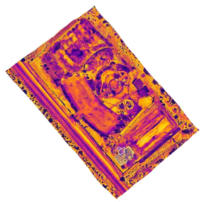
Gain critical insights with aerial thermal imaging, ideal for detecting heat anomalies in infrastructure, energy systems, and the environment. Our infrared-equipped drones identify energy loss, structural defects, water intrusion, and equipment failures—helping industries like utilities, construction, and agriculture enhance efficiency. Additionally, our thermal imaging technology aids in search and rescue operations, helping locate people and animals in low-visibility conditions or hazardous environments.
"The drone is top quality and fits perfectly into our operations!"

"The drone is high-quality and easy to operate!"

"The drone service is both reliable and incredibly efficient!"